
Complete Guide to the Ina Clan Jinya (Saitama Prefecture): The Full Picture of the Historic Remains that Became the Base of the Kanto Regional Governor
The Ina Clan Jinya (Ina Clan Residence Site), located in Ina-machi, Kita-Adachi-gun, Saitama Prefecture, is a jinya built by Ina Tadatsugu, the Kanto Regional Governor who played a crucial role in Tokugawa Ieyasu’s rule of the Kanto region. Constructed in 1591, this jinya served as the base of the Ina clan, who contributed to the foundation of the Edo Shogunate, and for approximately 30 years, it was the center of regional governance in Kanto. Even today, the remains, such as earthworks and moats, are well-preserved and protected as a Saitama Prefecture designated historical site.
Historical Background of the Ina Clan Jinya
Origins of the Ina Clan and Service to the Tokugawa Family
The Ina clan was a samurai family originating from Ina, Shinshu (present-day Nagano Prefecture). In the time of Ina Tadatsugu’s grandfather, Ina Tadamoto, they served the Tokugawa clan and became the lords of Kojima Castle in Mikawa Province (present-day Nishio City, Aichi Prefecture). Tadatsugu’s father, Ina Tadaiye, rose to prominence during the chaotic period following the Honnoji Incident in 1582, gaining the trust of Tokugawa Ieyasu.
After his father’s death, Ina Tadatsugu entered Tokugawa Ieyasu’s service at a young age, and his talents were recognized. He excelled particularly in administrative abilities and civil engineering, playing a crucial role in Ieyasu’s entry into the Kanto region.
Entry into Kanto and Granting of Territory in 1590
In 1590, after Toyotomi Hideyoshi’s siege of Odawara, Tokugawa Ieyasu was ordered to relocate to the Kanto region. Following this entry into Kanto, Ina Tadatsugu was granted the Komuro and Konosu territories of Musashi Province, Adachi District, with a staggering 13,000 koku.
The location Tadatsugu chose for his encampment was a strategically important site overlooking Genjinuma Marsh. This site was originally home to the Akaibo residence of Muryoji Temple, and it is said that even further back, there was a medieval castle called Maruyama Castle. Tadatsugu seized the Akaibo residence and renovated it into a military camp in 1591.
Role as Kanto Regional Governor
Ina Tadatsugu was appointed as the Kanto Regional Governor (later Kanto Regional Governor), and was entrusted with governing the shogunate’s direct territories (tenryo) throughout the Kanto region. His duties were wide-ranging, encompassing land surveys, tax collection, supervision of flood control and water utilization projects, promotion of new land development, and road maintenance—in short, he was responsible for the overall governance of the Kanto region.
Tadatsugu particularly excelled in flood control projects. He made significant contributions to flood control and new land development in the Kanto Plain, including the Tone River diversion project, river improvements on the Arakawa and Tamagawa rivers, and the construction of the Minuma-dai irrigation canal. These projects were essential to the development of Edo and the improvement of agricultural productivity in the Kanto region.
He also dedicated himself to the development of the Tokaido road, promoting the improvement of post towns such as Shinagawa-juku and Kawasaki-juku. Due to these achievements, Ina Tadatsugu is highly regarded for his significant contributions to Tokugawa Ieyasu’s rule over the Kanto region and, ultimately, to laying the foundation for the establishment of the Edo Shogunate.
Changes in the Jinya and Relocation to Akayama Jinya
After Ina Tadatsugu’s death, his son, Ina Tadamasa, inherited the family headship. However, when Tadamasa died in 1618, a major change occurred during the time of his son, Ina Tadaharu. Around 1633, Tadaharu began construction of a new Jinya in Akayama, Kawaguchi City, and completely transferred its functions to the Akayama Jinya in 1642.
This marked the end of the approximately 50-year history of the Ina clan’s Jinya in Komuro. The reasons for the relocation to Akayama Jinya are thought to include the choice of a location closer to Edo and improved transportation access, but the details remain unclear.
Structure and Remains of the Ina Clan Jinya
Scale and Layout of the Jinya
The Ina clan Jinya was a large-scale jinya (fortified residence) with an oval-shaped site approximately 350 meters east-west and 750 meters north-south. With a total area of approximately 26 hectares, it was more of a castle-like facility than a simple jinya.
The jinya was surrounded by a small earthen rampart and functioned as a natural fortress utilizing the waters of Haraichi Marsh. Areas where earthen ramparts could not be built due to the marsh were defended by moats, providing military defensive capabilities. This indicates that it was built as a key point in the northern defenses of Edo during the period immediately following the Hojo clan’s entry into the Kanto region, when their influence was still evident.
Existing Remains
Currently, the following remains are preserved at the Ina clan Jinya site:
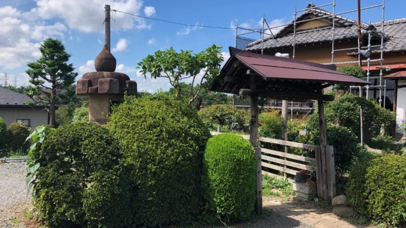
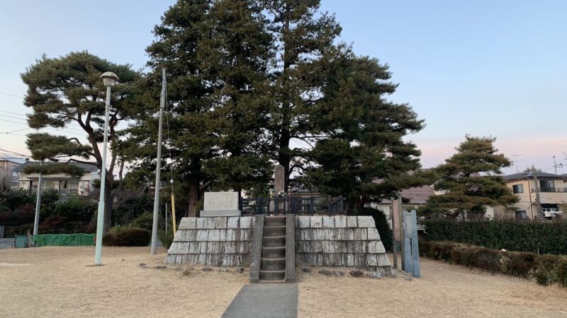
Earthworks: A portion of the earthworks surrounding the encampment remains in good condition. The height varies depending on the location, but the best-preserved sections are approximately 2-3 meters high. There are places where you can walk on top of the earthworks, allowing you to appreciate the scale of the defensive structures at the time.
Moat: Traces of a water moat can be seen in some areas. While much of it is now filled in, the location of the moat can be inferred from the topography.
Paths: The layout of the paths within the encampment remains, providing clues to the original layout. Traces of paths leading to the front and back gates can also be seen.
Traditional Place Names and Facility Layout
Place names indicating the facilities of the time are traditionally preserved at various locations within the encampment site.
- Front Gate: The location of the main entrance to the Jinya (fortified residence).
- Back Gate: The rear entrance to the Jinya.
- Storehouse: The location of the storehouse where tribute rice and other supplies were stored.
- Jinya: The central area where the Ina clan’s residence was located.
These place names provide valuable clues to understanding the structure of the Jinya, given the limited available historical documents. Interviews with local elders are revealing a more detailed layout of the facilities.
Characteristics as a Medieval Castle
Although the Ina clan’s Jinya is called a “Jinya,” its structure strongly retains characteristics of a medieval castle. Many elements are common to castles of the Sengoku period, such as defensive structures using earthworks and moats, a layout that utilizes the natural terrain, and a vast site.
This reflects the historical context of the time, immediately after Tokugawa Ieyasu’s entry into the Kanto region, when the memory of war was still fresh and military preparedness was necessary. In fact, remnants of the Hojo clan and forces dissatisfied with Toyotomi Hideyoshi existed in the Kanto region, requiring vigilance.
Cultural Value of the Ina Clan Residence
Designation as a Saitama Prefecture Historic Site
The Ina Clan Residence Site (Ina Clan Residence Site) was designated a Saitama Prefecture Historic Site on March 31, 1934. Reasons for the designation include its value as a surviving structure illustrating the realities of Kanto’s rule in the early Edo period, and its importance as a historical site commemorating the achievements of Ina Tadatsugu.
As a prefecturally designated historical site, efforts are underway to preserve and utilize the remains, including regular mowing and tree management. Furthermore, efforts are being made to create an environment where visitors can learn about history, such as installing explanatory signs and developing walking paths.
Historical Significance
The Ina Clan Residence Site has the following historical significance:
- Formation of the Foundation of the Edo Shogunate: As the base of the Kanto Regional Governor, it played a crucial role in establishing the Edo Shogunate’s governing system.
- Center of Flood Control and Development Administration: This was the base that directed flood control and land reclamation projects in the Kanto region, including the Tone River eastward diversion project.
- Tokugawa Ieyasu’s Rule over Kanto: This site contains concrete remains that demonstrate the system of rule immediately after Ieyasu’s arrival in Kanto.
- Witness to Local History: This is the root of Ina Town’s history and a place that tells the story of the Ina clan, from whom the town’s name originates.
Preservation Status and Challenges
The Ina Clan Jinya Site is a valuable historical site in Saitama Prefecture, where urbanization is progressing, as its remains are relatively well preserved. However, it also faces the following challenges:
- Some land is privately owned, making overall preservation and development difficult.
- Some areas of the remains are obscured by overgrown trees.
- Many areas have not undergone detailed excavation, so the overall picture is not fully understood.
- There are insufficient facilities for visitors, such as guided tours and parking.
In Ina Town, to address these challenges, discussions with landowners and the formulation of a phased development plan are underway. ## Visitor Information
Access
Access by Train
Approximately 5 minutes on foot from Maruyama Station on the Saitama New Urban Transit Ina Line (New Shuttle). Maruyama Station is approximately 20 minutes from Omiya Station.
- Take the New Shuttle from JR Omiya Station
- Get off at Maruyama Station
- Walk southeast from the station
Access by Car
- Approximately 15 minutes from the Tohoku Expressway Iwatsuki Interchange
- Approximately 20 minutes from the Shuto Expressway Saitama Omiya Line Shintoshin Nishi Interchange
- Parking: There is no dedicated parking lot, but there are public parking facilities nearby.
Address
Komuro Maruyama, Ina-machi, Kita-Adachi-gun, Saitama Prefecture
Points to Note During Your Visit
Visiting Hours
As this is an outdoor historical site, it is generally open 24 hours a day, but we recommend visiting during daylight hours.
Tips for Visiting
- Walk on the Earthworks: Walking on the well-preserved earthworks will give you a real sense of the scale of the fortified residence.
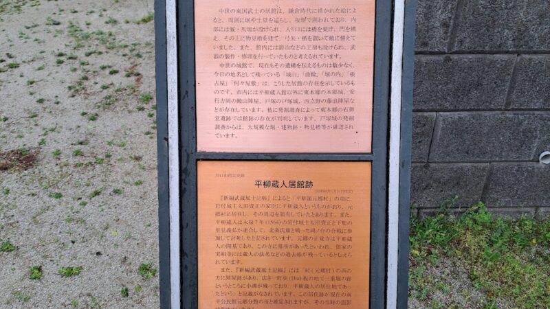
- Check the Information Boards: Check the information boards installed on-site to confirm the location and meaning of each structure.
- Observe the Topography: Paying attention to the subtle undulations of the terrain, such as the remains of moats and roads, will reveal the structure of the time.
- Choose the Right Season: The remains are easier to see from autumn to spring than in the summer when the grass is overgrown.
Estimated Time Required
If you want to leisurely view the entire fortified residence site, allow about one hour.
Nearby Related Facilities
Ina Town Establishment Memorial Hall
This hall has exhibits on the history of Ina Town and the Ina clan. Visiting before or after your visit to the fortified residence site will give you a deeper understanding.
Muryoji Temple
This temple is located near the fortified residence site and has strong ties to the Ina clan.
Other Remains at the Ina Clan Residence Site
There are several historical sites related to the Ina clan scattered around the site of the former residence. If you have time, we recommend taking a stroll around.
Precautions for Visiting
- Some areas are private property, so please do not enter restricted areas.
- Please be careful not to damage the remains.
- Please take all your trash with you.
- Insect repellent is recommended during the summer months.
- Some areas have uneven ground, so please wear comfortable shoes.
Ina Tadatsugu’s Achievements and the Development of Kanto
Tone River Diversion Project
One of Ina Tadatsugu’s most important achievements was the Tone River Diversion Project. This project was a grand plan to change the course of the Tone River, which originally flowed into Edo Bay (Tokyo Bay), to the east and divert it towards Choshi.
This project reduced flooding in Edo and made it possible to develop new rice fields. Furthermore, river transport using the Tone River developed, establishing an important logistics route connecting Kanto and Tohoku. ### Construction of the Minuma-dai Irrigation Canal
The reclamation of Minuma (present-day Saitama City, Saitama Prefecture) and the construction of its irrigation canal were also important achievements of Ina Tadatsugu. By reclaiming Minuma and developing new rice fields, and simultaneously improving the irrigation canal, he significantly increased the agricultural productivity of the surrounding area.
This project later developed into the Minuma-dai Irrigation Canal, which still functions as an important agricultural water source in eastern Saitama Prefecture today.
Flood Control of the Arakawa and Tama Rivers
He also undertook river improvement work on the Arakawa and Tama Rivers, mitigating flood damage and promoting the development of new rice fields. In particular, the diversion of the Arakawa River’s course enabled the development of the Musashino Plateau, greatly contributing to the development of Edo (present-day Tokyo).
Development of the Tokaido Road
The development of post towns along the Tokaido Road was also an important task for Ina Tadatsugu. He promoted the development of post towns such as Shinagawa-juku and Kawasaki-juku, establishing the function of an important highway connecting Edo and Kyoto. This facilitated the smooth movement of people and goods, promoting economic development. ### Land Survey and New Land Development
By conducting land surveys throughout the Kanto region and accurately determining the rice yield, Ina Tadatsugu achieved fair tax collection. Furthermore, he actively promoted the development of new land, dramatically improving agricultural productivity in the Kanto region.
Due to these achievements, Ina Tadatsugu is highly regarded as the “developer of Kanto.” This Ina clan residence served as his base of operations.
Relationship between Ina Town and the Ina Clan
Origin of the Town Name
The current name of Ina Town is derived directly from the Ina clan. When Komuro Village and Kobari Village merged to form Ina Town in 1970, the name of the Ina clan, who ruled this area, was adopted as the town name.
This reflects respect for the Ina clan, who laid the foundation for the town’s development, and a commitment to passing on their history to future generations.
Cultural Property Preservation Activities in Ina Town
Ina Town is committed to the preservation and utilization of cultural properties, including the Ina Clan Residence Site. The Cultural Properties and Town History Section of the Lifelong Learning Division is leading the following activities:
- Regular maintenance of historical sites
- Creation of explanatory signs and pamphlets
- Holding history lectures for town residents
- Promotion of local history education in schools
- Continuing cultural property surveys and research
Ina Town as a “Town of Roses”
Ina Town is also known as a “Town of Roses.” Many roses are planted in the town’s commemorative park, and a “Rose Festival” is held every May. The town is working to create an attractive place where history and nature harmonize.
When visiting the Ina Clan Residence Site, you can also enjoy the rose garden depending on the season.
Future Prospects for the Ina Clan Residence Site
Development Plan
Ina Town is planning further development of the Ina Clan Residence Site. Specifically, the following initiatives are being considered:
- Detailed clarification of the remains through archaeological excavations
- Improvement of information facilities (e.g., establishment of guidance facilities)
- Development of walking trails and improvement of signage
- Securing parking facilities
- Providing information using digital technology (AR, VR, etc.)
Utilization as a Tourism Resource
Efforts are underway to utilize the historically valuable Ina Clan Encampment Site as a tourism resource. This includes establishing sightseeing routes in conjunction with nearby historical sites and tourist facilities, and conducting guided tours.
Utilization as an Educational Resource
Local elementary and junior high schools conduct lessons visiting the Ina Clan Encampment Site as part of their local history curriculum. It plays an important role as a place where children learn about local history and deepen their attachment to their hometown.
Future plans include further enrichment of learning programs and the introduction of experiential learning.
Inquiries
For detailed information about the Ina Clan Encampment Site and inquiries regarding visits, please contact the following:
Ina Town Hall, Lifelong Learning Division, Cultural Properties and Town History Section
- Address: 9493 Komuro, Ina-machi, Kita-Adachi-gun, Saitama Prefecture 362-8517
- Phone: 048-721-2111 (Main)
- Office Hours: Weekdays 8:30 AM – 5:15 PM (Excluding Saturdays, Sundays, national holidays, and New Year holidays)
Information regarding the Ina Clan Jinya Ruins is also available on the Ina Town official website. We recommend checking the latest information and visiting guidelines before your visit.
Summary
The Ina Clan Jinya Ruins (Ina-machi, Saitama Prefecture) are historically significant jinya (fortified residence) ruins built by Ina Tadatsugu, the Kanto regional governor who supported Tokugawa Ieyasu’s rule of the Kanto region. Constructed in 1591 (Tensho 19), it functioned as the center of regional administration in Kanto until 1618 (Genna 4).
The site, spanning approximately 350 meters east-west and 750 meters north-south, boasts remarkably well-preserved remains such as earthworks and moats, and is protected as a Saitama Prefecture designated historical site. More than just a simple encampment, it retains strong characteristics of a medieval castle, telling the story of the tense period immediately following Tokugawa Ieyasu’s entry into the Kanto region.
Ina Tadatsugu used this encampment as his base to make significant contributions to the development of the Kanto region, including flood control and water utilization projects such as the Tone River diversion project, land reclamation, and the construction of the Tokaido road. His achievements were indispensable to the foundation of the Edo shogunate.
Currently, the Ina encampment site is conveniently located about a 5-minute walk from Maruyama Station on the New Shuttle line, making it easily accessible. Walking along the earthworks and experiencing the original land divisions, one can reflect on the realities of Kanto’s rule in the early Edo period, making it a valuable historical site.
Ina Town is committed to the preservation and utilization of this valuable historical site, and further development is planned for the future. If you’re interested in history, want to see castle ruins, or want to learn about the achievements of the Ina clan, you should definitely visit. You’ll be able to feel the spirit of Kanto’s development from over 400 years ago.