
Complete Guide to Otafunbe Chashi Ruins (Urahoro Town, Hokkaido) | A Thorough Explanation of the History of Ainu Conflicts and Highlights
Located on the Pacific coast of Urahoro Town, Tokachi District, Hokkaido, the Otafunbe Chashi Ruins are an important historical site that conveys the history of the Ainu people. Designated as a national historical site, this ruin is the site of a fort (chashi) once built by the Ainu people, and is attracting attention as a valuable place that tells the story of the conflicts and lives of the time.
This article comprehensively explains information about the Otafunbe Chashi Ruins, including its historical background, the meaning of the place name, its current state, access methods, and points to note when visiting.
What is Otafunbe Chashi?
Basic Knowledge of Chashi
Chashi (or Chashi) is an Ainu word meaning “fence” or “fort.” More than 500 chashi ruins have been confirmed throughout Hokkaido, and many of them were built on hills with good views or on the tips of capes.
There are various theories regarding the purpose of the Chashi, but it is generally believed to have been used primarily for the following purposes:
- Military defensive structure: A fort during conflicts with other groups
- Sacred site/ritual site: A place for rituals and prayers
- Charanke site: A place for negotiations and discussions
- Watchtower: Monitoring fishing and hunting grounds
Otafunbe Chashi is thought to have had a strong character as a military defensive structure due to its location and structure.
Meaning of the place name Otafunbe
“Otafunbe” is a place name derived from the Ainu language and can be broken down into “Ota-fun-pe.” Its meaning is interpreted as “a sandy beach where whales gather” or “a place on a sandy beach”.
- Ota: sand, sandy beach
- Hun: approach, enter
- Pe: thing, place
This region is a coastline facing the Pacific Ocean, and it is presumed that whales were once beached here. For the Ainu people, whales were a valuable food resource and were cherished as a gift from the gods. This place name offers a glimpse into the natural environment and the lives of the people at that time.
Historical Background of the Otahunbe Chashi Site
Ainu Conflicts and the Role of Chashi
From the 17th to the 18th centuries, conflicts occurred between Ainu groups in eastern Hokkaido. This region, particularly located on the border between the Tokachi and Kushiro regions, was the front line of conflicts over fishing rights and hunting grounds.
Otahunbe Chashi is thought to be a defensive structure built during these conflicts. Located on a plateau approximately 30 meters above sea level, its excellent vantage point overlooking the surrounding area made it ideal for early detection of approaching enemies.
The Encroachment of the Japanese and Changes in Ainu Society
From the 18th century onward, the expansion of trade by the Matsumae Domain and the encroachment of the Japanese forced significant changes into Ainu society. Tensions arose between the Ainu and the Japanese, as exemplified by the Battle of Kunashiri-Menashi in 1789.
While it is unclear exactly when the Otafunbe Chashi was actually used, it is presumed to have ceased use by the 19th century. Today, only its traces quietly tell the story of history.
Structure and Characteristics of the Otafunbe Chashi Site
Topography and Location
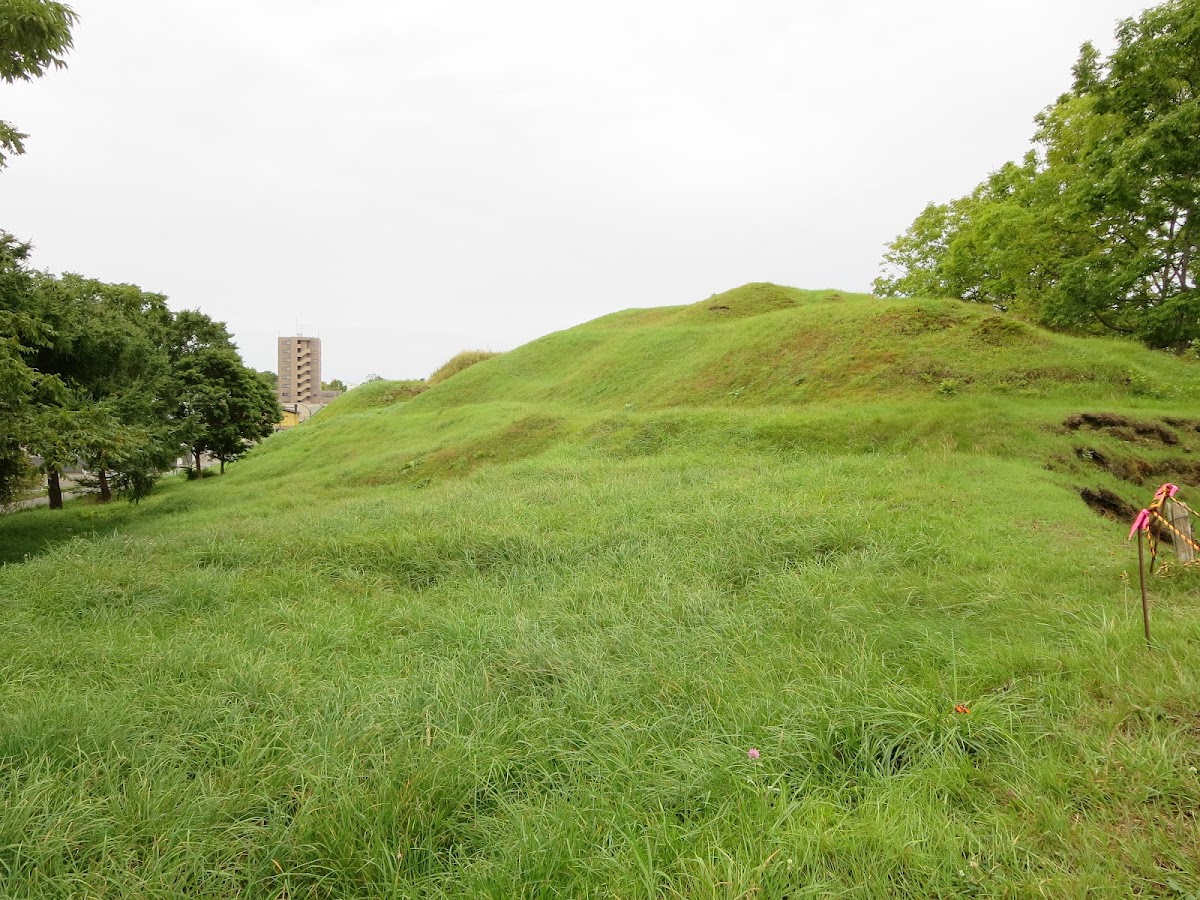
The Otafunbe Chashi site is located on a coastal terrace facing the Pacific Ocean. It lies along Hokkaido Prefectural Road 1038 (Chokubetsu-Kyoei Line), which runs from the mouth of the Tokachi River towards Kushiro, and is visible from a distance as a distinctive trapezoidal hill.
Main Topographical Features:
- Elevation: Approximately 30 meters
- Shape: A flat, trapezoidal plateau
- Area: Estimated several hundred square meters
- Surroundings: Surrounded by steep slopes, forming a natural defensive wall
This plateau offers a panoramic view of the Pacific Ocean, making it an ideal location for monitoring approaching forces from the sea and surrounding movements.
Current State
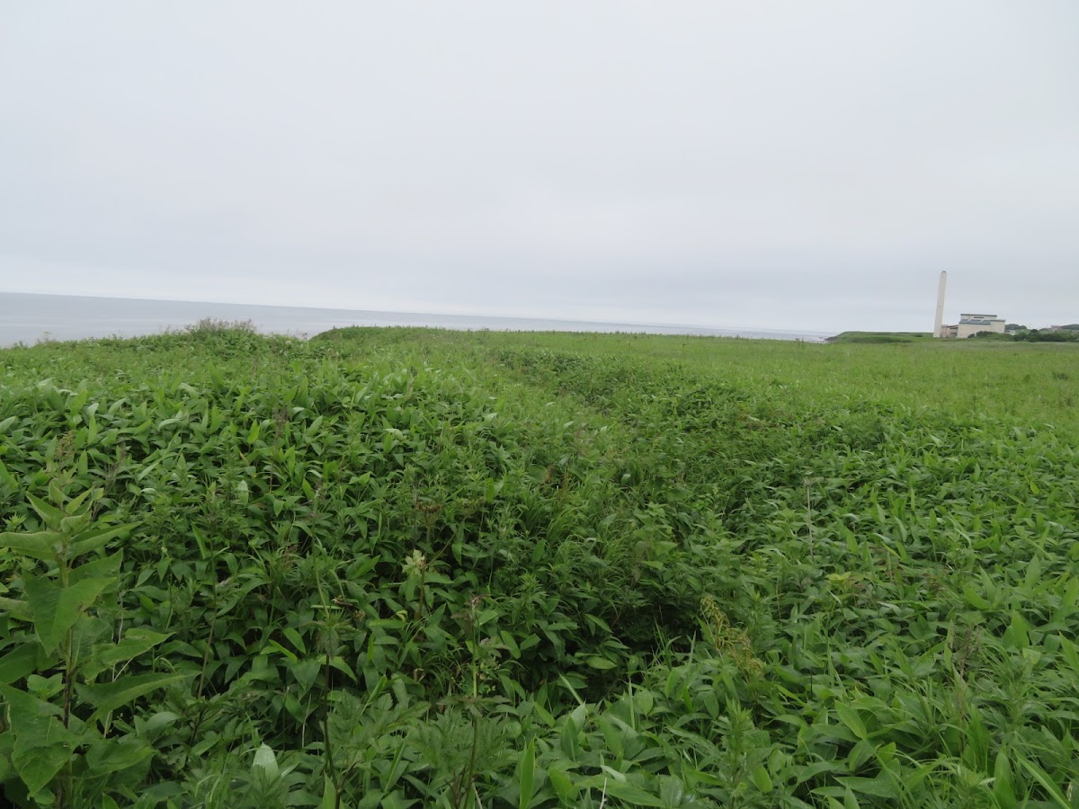
The current Otafunbe Chashi site presents a landscape resembling a pristine flower garden, covered in bamboo grass and other vegetation. Especially in early summer, Ezo daylilies (Hemerocallis middendorffii) bloom profusely, coloring the plateau with their yellow flowers.
Vegetation Characteristics:
- Bamboo grass grows densely throughout
- Coastal plants such as Ezo daylilies
- In early spring, the bamboo grass is low, making it easy to observe the topography of the ruins
- In summer, the bamboo grass grows tall, limiting visibility
The site itself is protected as a national historic site, and an explanatory sign is installed on-site. However, no buildings remain, and we can only imagine its former appearance from the topography.
How to Access the Otafunbe Chashi Site
Location
Address: Atsunai, Urahoro-cho, Tokachi-gun, Hokkaido
Access by Car
The most convenient way to access the Otafunbe Chashi Site is by car.
Travel Time from Major Cities:
- From Obihiro City: Approximately 1 hour 30 minutes (via National Route 38 and National Route 336)
- From Kushiro City: Approximately 1 hour (via National Route 38)
- From Sapporo City: Approximately 4 hours (via the Hokkaido Expressway and National Route 38)
Specific Route:
- From the Tokachi River estuary, take Hokkaido Prefectural Road 1038 (Chokubetsu-Kyoei Line) towards Kushiro.
- There is a vehicle access point before the curve past the Atsunai area.
- Look for the information sign (parking space for about one car available).
Access by Public Transportation
Access by public transportation is limited. Taking a taxi from the nearest Urahoro town center or renting a car is the most practical option.
Points to Note When Visiting
- Parking: There is no dedicated parking lot; only about one car can park in the space along the roadside.
- Restrooms: There are no restroom facilities on site.
- Cell Phone Signal: Signal may be weak in some areas.
- Clothing: Long sleeves and long pants are recommended due to the dense bamboo and grass.
- Season: Early spring (April-May) is ideal for viewing as the bamboo is still low.
Points to Note and How to Enjoy Your Visit
Recommended Time to Visit
Spring (April-May)
- The bamboo has not yet grown, making it easy to observe the topography.
- Ideal for understanding the structure of the Chashi (fortified settlement).
- The temperature is mild, making it suitable for strolling.
Early Summer (June-July)
- The Ezo daylilies bloom, offering beautiful scenery.
- A good season for photography.
- However, be careful of your footing as the bamboo begins to grow.
Autumn (September-October)
- Beautiful autumn foliage and sea views.
- Relatively cool and pleasant for strolling
Points to check during your visit
- Plateau shape: Observe the traces of artificial erosion and flat areas
- Surrounding slopes: How were the steep slopes formed for defense?
- View: Check the view of the Pacific Ocean and surrounding areas
- Contents of the information board: Learn about the historical background and the origin of the place name
Photography tips
- Wide-angle lens: Capture the entire plateau and the sea view in one shot
- Early morning/evening: Shooting with soft light creates a nice atmosphere
- Season of Ezo daylilies: The contrast between the yellow flowers and the blue sea is beautiful
- Drone photography: The trapezoidal topography is clearly visible from above (conduct after checking legal regulations)
Nearby tourist spots
Highlights of Urahoro Town
Tokachi River Estuary
- Approximately 15 minutes by car from Otafunbe Chashi
- Vast estuary and the view of the Pacific Ocean
- Popular as a birdwatching spot
Urahoro Shrine
- Located in the town of Urahoro
- A shrine where you can feel the history of the region
Nearby Chashi Sites
Many Chashi sites are scattered throughout eastern Hokkaido.
Kushiro River Basin Chashi Sites
- Multiple Chashi sites within Kushiro City
- Designated as a National Historic Site
- Visiting together with Otafunbe Chashi deepens understanding
Nemuro Peninsula Chashi Sites
- Numerous sites including Notsukamafu Chashi
- An important historical site for learning about Ainu culture
Tokachi/Kushiro Area Tourism
Tokachigawa Onsen
- Approximately 20 minutes by car from Obihiro City
- Famous for its moor hot springs
Kushiro Marshland
- Japan’s largest marshland
- Stunning views from the observation deck
Akkeshi Town
- Famous as an oyster producing area
- Akkeshi Lake and Bekanbeushi Marshland
Otafunbe Chashi Site and Cultural Property Protection
National Historic Site Designation
The Otafunbe Chashi site is designated as a National Historic Site as an important Ainu cultural site. This designation ensures the preservation and proper management of the site.
Significance of Historic Site Designation:
- To pass on the history and culture of the Ainu people to future generations
- To protect it as a subject of academic research
- To establish the historical identity of the region
- To utilize it as a tourist resource
Understanding and Respecting Ainu Culture
When visiting the Otafunbechashi site, understanding and respecting the history and culture of the Ainu people is important.
Things to keep in mind when visiting:
- Treat the ruins as sacred places.
- Always take your trash with you.
- Do not damage plants or the terrain.
- Follow the information boards and signs.
- Maintain a willingness to learn about Ainu culture.
To learn more about Ainu culture
Ainu cultural facilities in Hokkaido
Upopoy (National Ainu Museum and Park)
- Opened in Shiraoi Town in 2020.
- A facility centered around the National Ainu Museum.
- Offers comprehensive learning about Ainu culture.
Nibutani Ainu Culture Museum
- Nibutani, Biratori Town
- Reconstruction of a traditional Chise (house).
- Extensive exhibition of Ainu crafts.
Akan Lake Ainu Kotan
- Akan Lake Onsen, Kushiro City
- Ainu cultural experience programs.
- Traditional crafts are available for purchase.
Related Books and Materials
The following materials are helpful for learning about Ainu culture and Chashi:
- Cultural property-related materials published by the Hokkaido Board of Education
- Exhibits at local history museums in each city and town
- Academic and general books on Ainu culture
Summary: The Value and Charm of the Otafunbe Chashi Site
The Otafunbe Chashi site is not merely an ancient ruin, but a precious place that conveys the history, culture, and way of life of the Ainu people. As the place name, “Sandy Beach Where Whales Come,” suggests, this area was blessed with abundant nature and was a place where people lived.
Although it is now a quiet plateau covered with bamboo grass and daylilies, when you imagine that this was once the front line of conflict and an important fortress where life and death were decided, you cannot help but feel the weight of history.
When you visit eastern Hokkaido, be sure to visit the Otafunbe Chashi site and reflect on the history of the Ainu people. Standing on the plateau overlooking the Pacific Ocean, you will be able to feel the breath of the people who lived here hundreds of years ago.
Pre-Visit Checklist
- [ ] Check access route (car is convenient)
- [ ] Check weather (sunny days are recommended)
- [ ] Appropriate clothing (long sleeves, long pants, comfortable walking shoes)
- [ ] Prepare camera or binoculars
- [ ] Bring drinking water and snacks
- [ ] Acquire prior knowledge about Ainu culture
- [ ] Plan nearby sightseeing spots
The Otafunbechashi ruins are an important historical site indispensable for understanding the history of Hokkaido. We hope this article will be helpful for your visit.